
Q&A with Maureen and Larry Gelo: Nomadic Retirees and Road Trip Professionals

Unity, New Hampshire
by Samantha Adler
Florida palm trees, luxurious naps and bingo: these are the things retirement dreams are made of.
But, if you travel up to woodsy New Hampshire and ask Maureen and Larry Gelo they’d beg to differ. A couple of retirement rebels, these two fill their time seeking new adventures on America’s open roads, breaking away from the status quo of retirees.
The two lived, worked and raised their children in Connecticut. He worked as a police officer in a small town on the shore and she worked as a nanny. Larry’s a handyman who can fix all and create any device you’d ever need from scratch. Maureen’s gentle and loving with a dash of cheeky spunk. After retiring at age of 62, they bought a motorhome and set off on a series of spontaneous road trips in North America, driven by curiosity and an unfulfilled wanderlust. It’s been over a decade and they’re still going, insisting there is so much to see in this big, beautiful country of ours.
This pair of serial roadtrippers happen to be my grandparents (+10 cool points for me) and two of the biggest supporters of the road trip. I recently visited them in Unity, New Hampshire, their home base. When they’re not out on the road, Larry does woodwork with materials from the forest behind their house (Check out some of his amazing work), visit friends, hike and enjoy their rugged New England home.
Before settling down over the kitchen table, we went on a short hike in the nearby Quechee Gorge. A few remaining leaves hung off wiry branches, clinging on against the chilly late autumn breeze. We got home, tore off hiking boots and unbundled. After putting a log on the furnace, we gathered around a plate of brownies and they shared their stories, travel advice and all their coveted road trip knowledge in their usual hilarious banter.
First off, why the travel retirement?
L: There’s a lot of places we’ve never been and we’d like to go there.
M: That pretty much says it all. We just wanted to travel and see this beautiful country.
Why roadtripping in particular?
L: Because you can see a lot more. And with a camper you can stop wherever, whenever and for as long as you want.
M: To get off the beaten path and see things. We’ve had so many surprises, especially in these little towns along the way. [There was] one place in Nebraska we ended up. It was the end of the day and we were tired. We just about got into this parking lot, when we saw there was a museum. Well, we ended up staying there for three more days because this museum was blocks long. A man had collected everything from soup to nuts; from cars to buttons. And he had all these buildings with all these wonderful things, like the earliest telephone. We found out that he was the creator of bubble wrap! And he just collected for years and years and years. But like I said when we pulled into this place it looked like nothing, it was just a place we stopped at because it was the end of the day and we were tired. So that’s the wonderful thing about traveling across this country in a vehicle.
Did you travel when you were younger?
M: I think the farthest we ever went was to visit my father’s sister in New York. And that was about three or four times in my childhood. Neither of my parents liked to travel, they were homebodies. So that gave me the wanderlust.
L: When I was single in the service and my teenage years, I used to travel down the East Coast, and that was it. But I did get to go to college in Alaska and loved it. About forty years ago we got the chance to take a cruise up there and loved it. Then we went back and spent eight or ten weeks traveling around in the motorhome.

What was your first road trip?
M: We had a trailer and we went up to Canada, Quebec and Niagara falls, on both sides. There again, we found this wonderful little town that we would have never found if we weren’t riding around.
L: We first started with a truck, we camped in the back of the truck, then we got a little trailer, then we got a little bigger trailer and then we decided [to get the RV] when we got close to retirement.
What was the best trip or route you’ve taken?
L: I think Alaska was probably the greatest. They’ve all been great. One time we went down Route 50 from the East Coast all the way out to California. It was the old 1950/60’s. Most of it’s disappeared by now, but it was kind of nostalgic and off the beaten path. It was stuff we remembered from when we were young.
M: Route 66.
L: Yea, a lot of it was Route 66. Another time we went along the Canadian border all the way west, then down the coast to San Francisco and then back along the southern coast. That was an amazing trip.
What was the craziest thing you saw because you were driving?
L: We’ve seen just about everything. We’ve been in tornados, major thunderstorms, hailstorms, windstorms where we thought the camper was going to flip over. Anything you can think of we’ve been near it, too near it for comfort or right in the middle of it.
Have you made any friends along the way?
L: We’ve met all sorts of people. You never know who you’re going to run into. We stopped in one place in Canada and met people we’ve been in touch with for seven or eight years now.
M: All nice people from all walks of life.
L: Everyplace you stop you should talk to somebody. You’ll talk about where you’ve been and where you’re going and they’ll tell you what you should go and see. And if they’ve been to places you’ve already been, they’ll tell you about places you missed after you thought you’ve seen everything there is to see. We went to Wall Drugs a few times going across country. It’s a big, big drug store and big tourist attraction. And almost across the street, were the Badlands. We drove right by it. The third time we finally figured it out after chatting with people.
What are the best things you’ve picked up along the way?
L: She likes to shop. We had to go all the way to Alaska to go to Walmart.
M: No. My best souvenirs were in Sequoia National Park, we filled our trunk with great big pinecones.
L: Then we found out it was illegal.
M: And then I got a piece of wood from the Petrified Forest. Which was...another illegal thing. Nothing I bought. I have a chunk of rock from the base of Crazy Horse. And that was legal! They said I could take it.
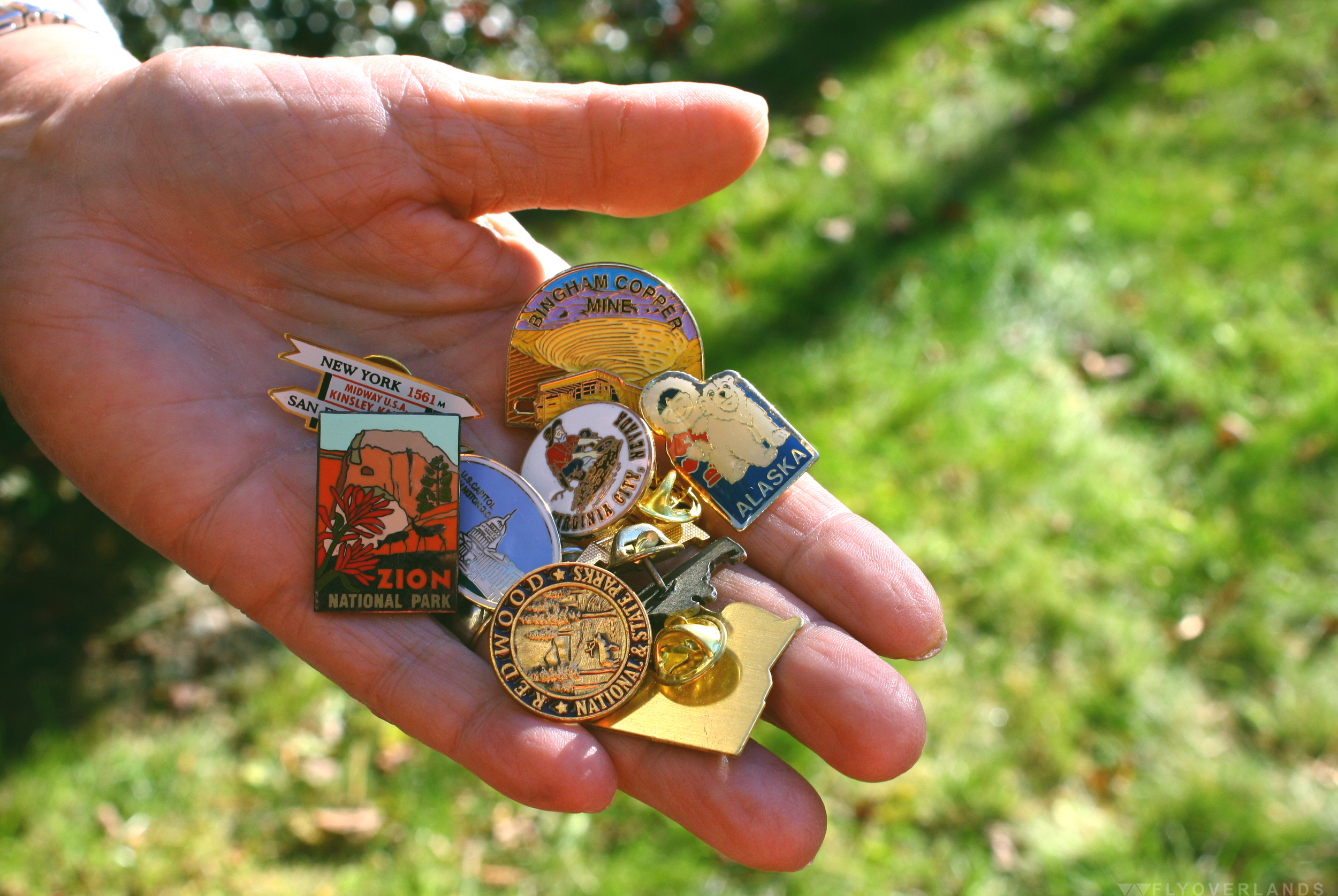
L: Every place we’ve gone to I’ve gotten a walking stick emblem.

I know you’ve had some run-ins with pretty large critters.
L: We saw every animal you could think of in Alaska: mountain lions, moose, bears. I’ve walked up on a moose. Not intentionally. I was walking along the road and right next to me a moose started snorting. I said “oh that’s not a smart idea.” I kept walking and he went back on to minding his own business.
Advice for aspiring roadtrippers?
L: It’s the most exciting way in the world to go. You don’t have to go on an airplane and go through all that crap. Travel as much as you can. You get a whole, totally different outlook on the world. You see it’s more than this little town you live in.
M: Enjoy the ride and the surprises. In Saint Louis we ended up seeing the Clydesdales from the Budweiser commercials at Grant’s Farm. That was a surprise that we came upon. It was in this beautiful nature park that had all types of animals. And it was totally free.
L: Talk to everyone you can talk to.
M: I like stopping at visitors centers because you can get all the information you need. It’s always good to stop there.
L: If you see something interesting you should stop. The most important thing about traveling like this is being able to stop when you see something interesting and if you don’t make your destination, fine.
The one place you must see in the US?
M: Grand Tetons.
L: When we were traveling to a balloon festival in Arizona, we hit every presidential library in the country. That was amazing, I never knew the presidential libraries had so much to offer.
What route do you recommend for someone who wants to road trip for the first time?
L: I think Route 50 was one of the nicest. If you can stay off the main highways, do it. The interstates are beautiful things for when you want to get somewhere fast, but you miss everything.
There’s so much to see. What should someone base their route on when planning?
L: No matter what you’re interested in look for things that are in that area. Like history, if you’re interested in battlefields you could spend months visiting them all in the southeast. Or if you find a writer you’re interested in...anything!
M: Just seeing the country and riding along.
L: We’ve got friends who like to go to zoos. They just travel all around the country going to zoos. It’s whatever you’re interested in.
M: I wanted to go to Savannah because I heard there was a museum here that had Scarlett O’Hara’s dress from Gone with the Wind. I was so excited because that’s one of my favorite movies. I never thought i’d be able to do that. Especially because I never traveled when I was younger, so it’s amazing to be able to hop in the motorhome, drive down and see something as ridiculous as Scarlett O’Hara’s gown.
L: One time we tried to hit as many national forests and parks as we could.
Has anything you’ve seen changed your perspective?
L: It’s changed our outlook on life. Before we started traveling the north east was basically it. Yea, I’d gone down south a few times for the service. But I’ve probably never gone more than 100 miles from the Atlantic Ocean. And it’s amazing. I thought everyone in the world lived in New York City; that was civilization. Then you find out Chicago is bigger. And the first time we went across country, to see how big this country is, where you’re driving and you can see fifty miles ahead, drive for hours and see nothing else. You can’t wrap your head around that or visualize that from reading a book or watching TV. You can’t appreciate it until you see it. And to see how different people live. It’s changing a bit now. But we’d hit totally different cultures and foods. I do carpenter work and I’ve seen carpenters make the same thing I make but in totally different ways, with different tools and different methods. That’s where you learn things.
So, you guys are the cool nomadic kids in your friend group.
M: Yea.
L: We dare a little more.
M: Some of our friends don’t follow us cause they feel we’re too old. They don’t want to get off the beaten path.
L: We’ll just go and if we stop, we’ll stop. We’re a little more daring, but everyone is different. It’s still nice to get home. Then regroup, reorganize and then take off again.


